A unified geospatial platform

Map the world.
Shape the future.

One unified GIS workspace for imagery, terrain, field data, and spatial analysis—from the desktop to the field, with seamless online and offline workflows.

100+Industries served
10M+Users
2D & 3DVisualization
Explore
Satellite Imagery Spatial Analysis Field Data Collection Offline Workflows 2D & 3D Visualization
Explore deeper details across data layers.

Designed for serious spatial work.

Work confidently with satellite imagery, elevation data, contour lines, vector data, building footprints, and points of interest.

Rich Data CompatibilityImport CAD, SHP, KML, imagery, and other common GIS formats into a unified workflow.
Responsive 2D & 3D RenderingNavigate large datasets and terrain with fast, clear visual feedback.
Desktop-to-Field ContinuitySynchronize project data and keep teams aligned across devices.
Elevation profile1,842 m
Active dataset24 layers
Professional desktop GIS

One workspace.
Every spatial task.

Manage complex geospatial data, perform advanced spatial analysis, and turn results into publication-ready maps—all within a unified workspace.

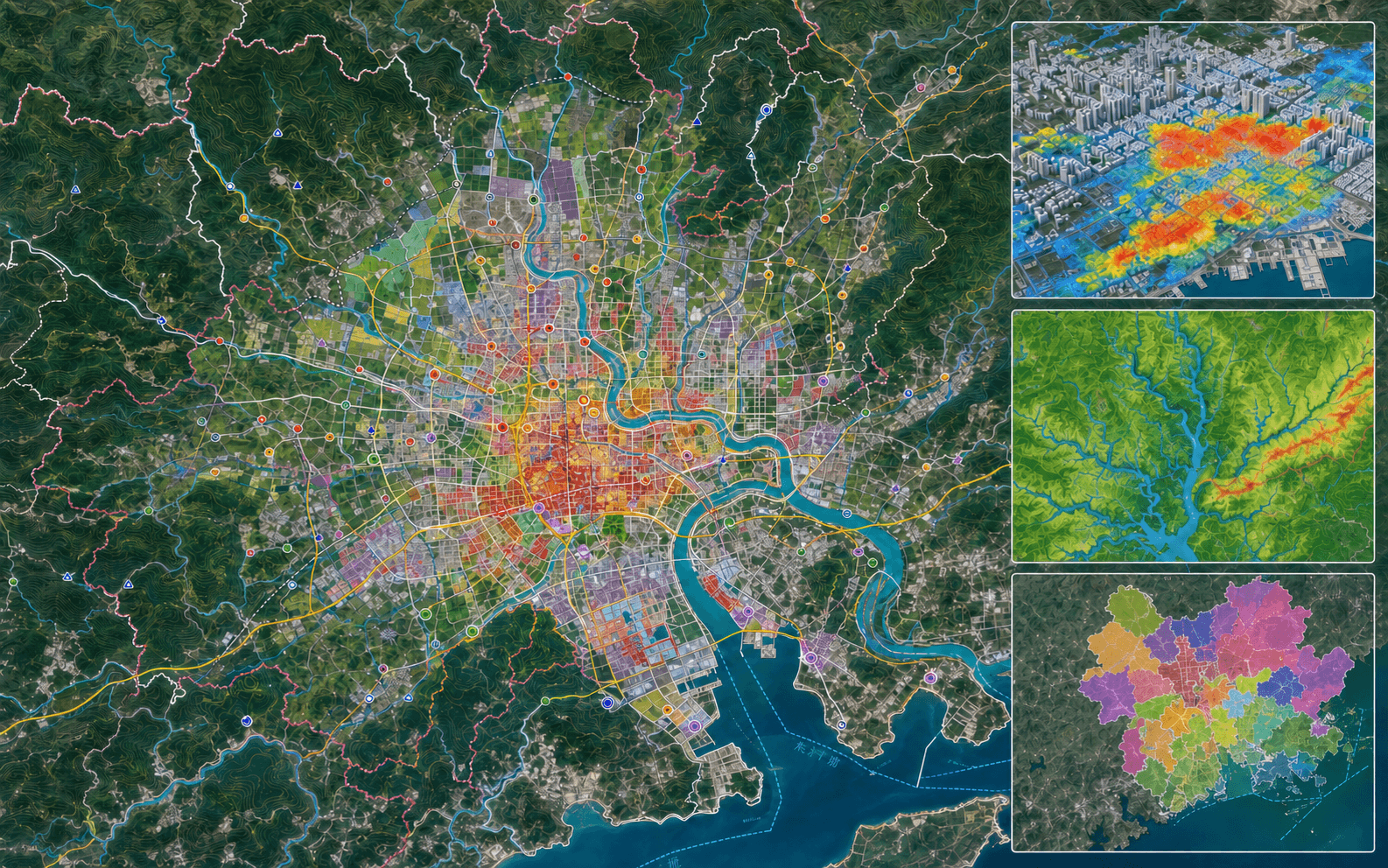
NewGIS data management workspace combining imagery, vector layers and large attribute datasets
01 / Data Management

Make every dataset clear and connected.

Import, edit, organize, and manage a wide range of geospatial data—from multispectral imagery and satellite data to aerial imagery, vector data, and raster grids. Seamlessly exchange data with CAD, GIS, and 3D applications.
Large DatasetsRaster & VectorData CleaningFormat Conversion
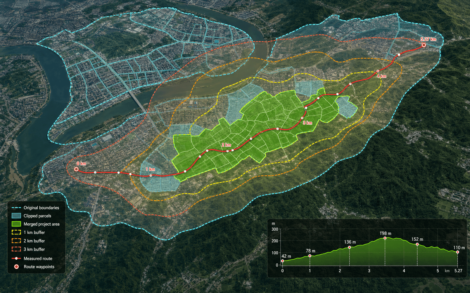
02 / Spatial Analysis

Turn Spatial Data into Insights.

Measure distances and areas, generate elevation profiles, clip and merge features, create buffers, and transform coordinate systems. Interactive tools provide real-time visual feedback, making complex geoprocessing intuitive and repeatable.

Distance & Area MeasurementClip & MergeBuffer AnalysisCoordinate Systems
NewGIS geometry processing workspace showing clip, merge, buffer and coordinate transformation operations
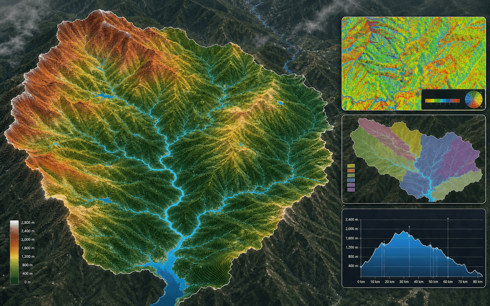
NewGIS spatial analysis workspace showing terrain, contours, watersheds, raster classification and heatmaps
03 / Spatial Analysis

Reveal Patterns Behind the Map.

Analyze terrain, raster data, watersheds, slope and aspect, image classification, and heatmaps to understand spatial patterns and make informed decisions.

Terrain AnalysisWatershed AnalysisRaster AnalysisHeat Maps
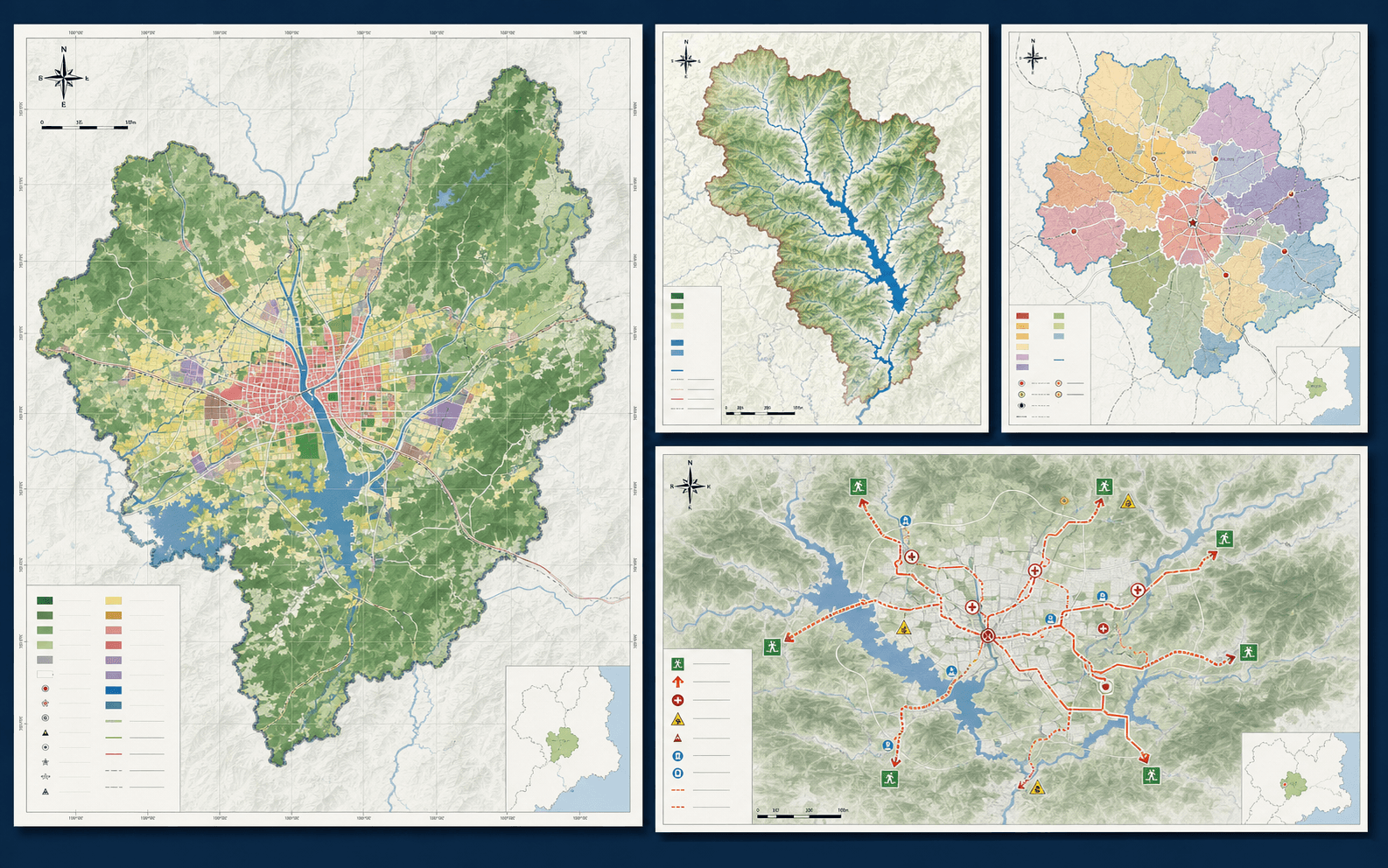
04 / Map Design & Export

From analysis to finished map.

Transform analysis results into publication-ready map layouts with intuitive design tools, legends, scale bars, north arrows, grids, and map series. Export, share, and archive maps for seamless collaboration across office and field teams.

Map LayoutsSymbols & LegendsMap SeriesPrint & Export
NewGIS cartographic layout workspace showing a finished map, legend, scale bar and export settings

Make your next geospatial project stand out.

Talk to Our Team ↗